Story of Stormwater
by Betsy White, BBAC Stormwater Specialist

Part I-Why Care
Why is caring about stormwater important? Rain is a major component of the water cycle and is responsible for depositing most of the fresh water on Earth. Among other things, it replenishes ground and surface waters, which are critical for drinking water supplies. And, if it existed in its purest form, just water and nothing else, this story would be short and sweet. Unfortunately, however, the tale is much more complicated than that.
Stormwater, which results from rain or snow melt, flows over land surfaces. As stormwater moves across the ground, especially developed land and paved surfaces, it washes pollutants into storm drains and directly into lakes, rivers and the ocean. Everything that we put on the ground or into storm drains can end up in our waters. Trash, oil and heavy metals from cars, fertilizers from lawns and agriculture, pet waste (and associated bacteria and pathogens), paints, pesticides, detergents from car washing, and sediment from construction sites. These are all common products of urban, suburban, and rural areas. There are very few places on Earth that do not contribute pollutants to water bodies.
Part II-What Are We Protecting and Why?
Stormwater to most people means flooded roads and basements, overflowing rivers, and slick and icy streets. These problems tend to be the result of heavy rains and/or snowmelt, but pollution is mobilized by much smaller storms. Stormwater is not something many people think about in terms of what it contains or where it ends up. However, where we live requires that we consider stormwater as a potential threat to the resources that are so important to our area. Everything that we put on the ground or into the storm drain can end up in our waters.
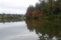
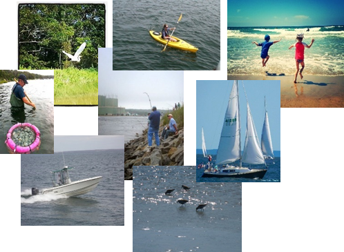
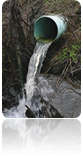
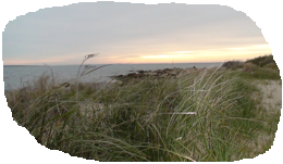
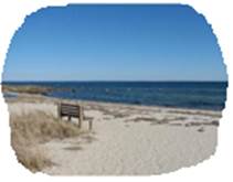
The resources that make this region so special are most vulnerable to stormwater pollutants. Ponds, lakes, streams, salt marshes, wetlands, and Buzzards Bay are all at the receiving end of stormwater runoff. This runoff can go directly into these waters from land and streets, or be directed into storm drain pipes underneath roadways which then discharge into surrounding waters.

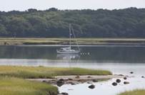
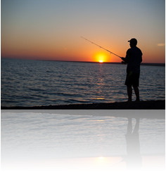
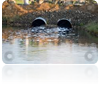
The coast of Buzzards Bay is lined with not only coves, saltmarshes, and tidal flats, but also stormwater outfall pipes. These private, town, and state owned pipes are designed to transport stormwater off the land quickly and into the bay. The goal of such a pipe system is to minimize flooding from storms and snowmelt that would often make roads impassable and threaten homes and businesses. When contaminated stormwater moves through these pipes and enters Buzzards Bay, it threatens so much of what the bay offers -- an abundance of wildlife, shellfishing, swimming, boating, and fishing, not to mention beauty.
Part III-Storm Drains and Manholes
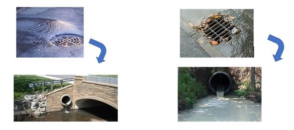
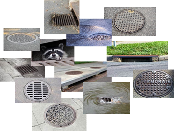
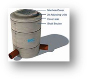
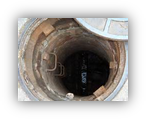
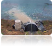
You have probably seen them and not paid much attention to them - manhole covers located on the surface of town roads. In fact, manholes can be found almost anywhere and can be access ports to many different municipal services -- electrical and telephone systems, sewer systems, and cable systems. One focus of the Stormwater Collaborative is on mapping manholes (and associated catchbasins) that provide access to municipal stormwater pipe systems.
In undeveloped areas, such as an open field or wooded forest, stormwater and snowmelt naturally soak into the ground and replenish ground water. The ground is pervious, meaning that it absorbs most of the stormwater into the ground. Locations that have been built up or are densely populated have a lot of impervious surfaces (concrete and asphalt) such as parking lots, buildings, and streets. These impervious surfaces do not allow rainfall to penetrate the ground. As a result, more stormwater "runs off" these surfaces causing flooding and erosion problems.
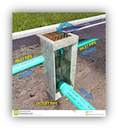
To alleviate these problems, cities and towns typically install drainage systems to remove stormwater quickly and safely from the road surfaces. Open grates along the road (catchbasins) collect stormwater from the road surfaces, and these catchbasins then drain into storm drain pipes. More complex drainage systems also include manholes, which serve as a collection port between catchbasins. The manholes are similar in structure to a catchbasin except the cover is solid (as opposed to open grated) and can be lifted to provide maintenance access to the pipe network. Pipes tend to run from manhole to manhole the length of a street, collecting water from the catchbasins along the way.
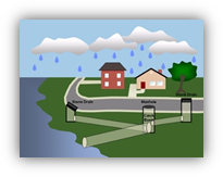
Not every street has pipe drainage, but most do, especially if they are new or have been reconstructed. Many densely developed villages and town centers along the coast usually have drainage systems. These systems are generally older and the sizing is inadequate to meet the needs of the current and future population, resulting in more street flooding during rain storms. These pipe systems, termed "stormwater infrastructure," have outlets that often discharge at a nearby water body, dumping polluted stormwater directly into bays, ponds, and streams.


OOutlets may also be located in wetlands or saltmarshes, which can act as giant filters, removing much of the pollution before it reaches a water body. Unfortunately, these natural filters can be overwhelmed by too much pollution and lose their ability to not only purify stormwater but to function as a healthy ecosystem.
Part IV-What is Being Done
Presently, there are numerous areas along the coastline impaired by bacteria and nitrogen pollution, with stormwater often a major contributor. Many efforts have been made by federal, state, and local groups to address stormwater pollution as required under the Clean Water Act (CWA). The CWA requires states to set water quality standards for all surface water bodies within their boundaries. Many waters in Massachusetts do not meet these standards and are considered impaired, including numerous estuaries, bays, and coves throughout Buzzards Bay. Much of this impairment is because of polluted stormwater runoff. The reality is that there are only so many pollutants that Buzzards Bay can handle and still remain healthy. Waters that states have determined to be impaired, be it for bacteria, nutrients, or other pollutants are officially listed and are required by the EPA to be cleaned up to healthy standards.
Under the CWA, EPA requires municipalities that have storm drain systems within "urbanized areas" (as defined by population data from the Census Bureau) to obtain a permit to discharge stormwater flows. Municipalities must address stormwater pollution by developing a Stormwater Pollution Management Plan and implementing a series of structural and non-structural management practices. All the municipalities within the Buzzards Bay watershed have at least part of the town in an urbanized area, and most of this urbanized area is within coastal communities. Storm drains within these urbanized areas are termed MS4s (municipal separate storm sewer systems). The goal of the MS4 program is to reduce the discharge of pollutants as much as possible in order to protect and enhance water quality. By requiring a permit for these discharges, the EPA is able to set guidelines and requirements that towns must follow in order to get their permit application approved.
Part V-The Work of the Collaborative
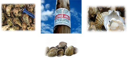
In 2016, the Buzzards Bay Action Committee (BBAC), working with the Buzzards Bay National Estuary Program (BBNEP), took a large step forward in the management of stormwater when they received an Environmental Protection Agency (EPA) grant to establish the Buzzards Bay Stormwater Collaborative -- a multi-municipal partnership to map municipal storm drain systems and monitor and test stormwater discharges for pollutants. Pollutant-laden stormwater flowing through storm drain systems discharge into local coastal areas and impact the health of these receiving waters. These waters may be considered "impaired" for shellfishing, which means that the level of pollution is unhealthy for human consumption of shellfish. In Buzzards Bay, there are roughly 6,000 acres of shellfish growing areas closed year-round to shellfishing, another 6,000 acres closed after 0.2 inches or more of rain, and roughly 3,000 acres seasonally closed. These closures are largely the result of bacterial contamination, resulting from stormwater discharges. Nitrogen pollution in stormwater can also degrade coastal waters.
The Buzzards Bay Stormwater Collaborative recognizes the importance of managing stormwater and minimizing its impacts. The economy of this region largely depends upon the health of Buzzards Bay and its resources. This project focuses on local impaired waters with the intent of creating a blueprint which other towns can use to develop their own stormwater monitoring program. A regional, committed effort will maximize the effects of each town's program while working to improve the quality of the waters of Buzzards Bay.
The EPA-funded project, titled Buzzards Bay Stormwater Collaborative: A Coordinated Intermunicipal Pilot Program to Map Stormwater Networks and Monitor Discharges to Impaired Surface Waters in the Buzzards Bay Watershed, focuses on five volunteer towns located around Buzzards Bay: Acushnet, Dartmouth, Fairhaven, Mattapoisett, and Wareham. These towns, through their representatives, work hand-in-hand with BBAC and BBNEP on the tasks involved and benefit by being able to apply the efforts and results towards specific municipal requirements, such as permitting and the reduction of the pollutant load to local waters.
The main areas of focus for this project are those coastal waters in each town that are considered impaired by bacteria. An exceedance of bacteria in coastal waters can cause the closure of shellfish beds.
The project involves a number of tasks, from sampling stormwater to mapping pipes. Fieldwork was undertaken during the summer and fall of 2016, and will resume in the spring of 2017. Tasks included:
- Locating discharge pipes along the coastline of the five towns. Ideally, these pipes are where stormwater samples are taken, as it is the culmination point of all the stormwater going through that pipe system.
- Mapping the pipe system from the discharge point to its upstream catchbasins and manholes. This establishes an alternative monitoring site if the discharge point is inaccessible (usually as a result of tidal heights). This task also begins the mapping requirements under the MS4 permit requirements.
- Sampling stormwater sites in both dry and wet conditions. Dry weather establishes baseline conditions and may indicate the presence of "illicit" (non stormwater connections and pollution) flow; monitoring during wet weather indicates the presence of stormwater runoff pollutants. The EPA MS4 permit requires the municipalities to assess and prioritize their MS4 drainage systems to remove "illicit" connections and address stormwater pollutants.
- Documenting, using GPS equipment, of every storm drain and storm manhole in each participating town.
Much of the 2016 fieldwork was accomplished by college interns, who worked throughout the summer with local Departments of Public Works in both fair and rainy weather. BBNEP staff provided field and technical assistance, as well as the establishment of monitoring sites. BBNEP staff also evaluated sample analysis results and prepared interim reports that were submitted to each participating town.
There were a number of measurements and tests conducted on the stormwater samples collected for this project. Because the project focused on coastal areas that are impaired for swimming and shellfishing by bacterial contamination, Enterococci was the indicator pollutant sampled. The levels of bacteria in the water are what determine the closures of shellfish beds, and these samples were sent to local laboratories for analysis. Other parameters tested included nitrogen and surfactants (detergents), as well as salinity and temperature. Nitrogen can be an indicator of fertilizer or waste (both animal and human), detergents can indicate illicit connections such as washing machines, and high salinity can mean seawater backing up into stormwater systems.
There were also a number of other tasks to be completed for this project:
- The GIS mapping of municipal stormwater infrastructure using local stormwater plans
- The creation and distribution of a flyer to all residents in the participating towns that provided information on stormwater and its management
- Providing project information and updates on organization websites
- The identification of possible "hot spots" where data indicates high levels of pollutants in each town, which may require remediation
- Interim and final report submissions
This project was funded for one year and is scheduled to conclude at the end of June. 2017 Unfortunately, there is currently no funding available to maintain this project. The participating towns have expressed an interest in continuing the program and additional towns have asked to participate. The monitoring program provides the basis for their MS4 permits and provides training to municipal staff to meet the remaining MS4 monitoring requirements. It is hoped that this project will serve as a model for other towns in the southeast New England coastal watershed region.
Part VI - What You Can Do
|
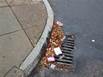
Keep storm drains free of debris |
|
|
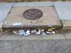
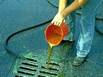
Do not dump anything down storm drains |
|
|
Use rain barrels to collect stormwater off of houses |
|
|
Pick up pet waste |
|
|
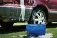
Wash your car on your lawn or at a car wash |
|
|
Use organic fertilizer or none at all |
|


Understanding how stormwater affects water quality, and recognizing how the actions by individuals and town government reduce pollutants in stormwater can go a long way toward protecting our shorelines and bays for today and for future generations.